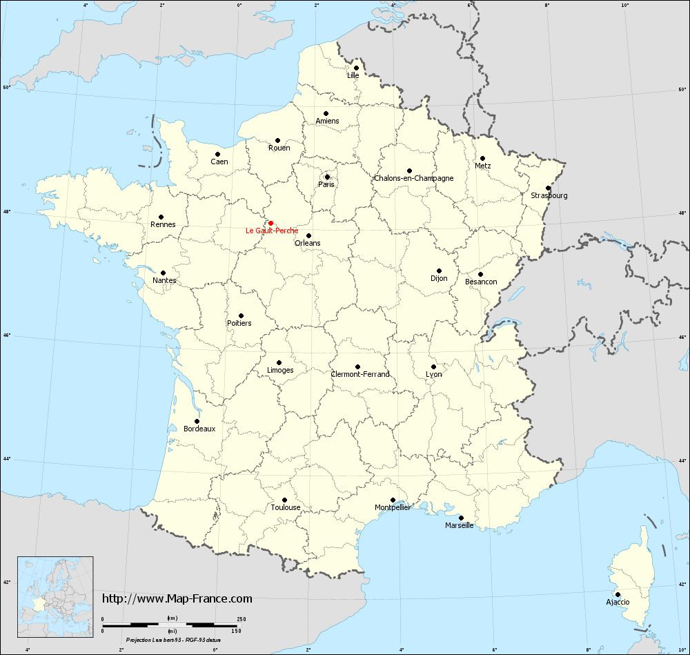
Le Gault-Perche on the relief France map in Lambert 93 coordinates
|

See the map of Le Gault-Perche in full screen (1000 x 949)
|
At left, here is the location of Le Gault-Perche on the relief France map in Lambert 93 coordinates.
Here are the altitudes of Le Gault-Perche :
- Town hall altitude of Le Gault-Perche is 210 meters
- Minimum altitude of Le Gault-Perche is 165 meters
- Maximum altitude of Le Gault-Perche is 228 meters
- Medium altitude of Le Gault-Perche is 197 meters
Here are the altitudes of Blois, prefecture of Loir-et-Cher department:
- Town hall altitude of Blois is 100 meters
- Minimum altitude of Blois is 63 meters
- Maximum altitude of Blois is 135 meters
- Medium altitude of Blois is 99 meters
Here are the altitudes of the french biggest cities:
Paris : 33 meters
Marseille : 20 meters
Lyon : 237 meters
Toulouse : 146 meters
Nice : 10 meters
Nantes : 20 meters
Strasbourg : 144 meters
Montpellier : 35 meters
Bordeaux : 16 meters
Lille : 20 meters
Rennes : 35 meters
Reims : 83 meters
Click here for the terrain map of Le Gault-Perche in full screen:
Relief map of Le Gault-Perche
|
This relief map of Le Gault-Perche is reusable and modifiable by making a link to this page of the Map-France.com website or by using the given code :
|
Terrain base map of Le Gault-Perche
|

See the terrain base map of Le Gault-Perche in full screen (1000 x 949)
|
Small relief base map of Le Gault-Perche

|
This base map of Le Gault-Perche is reusable and modifiable by making a link to this page of the Map-France.com website or by using the given code :
|
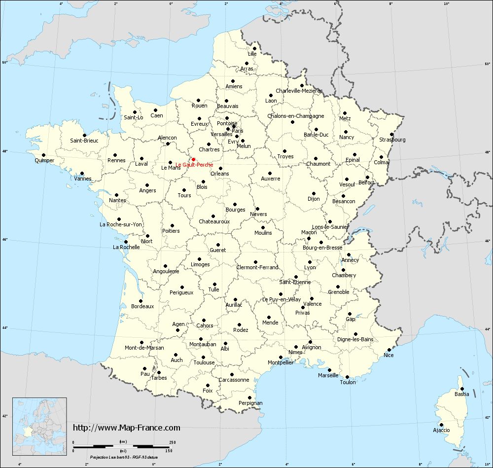
Map of Le Gault-Perche with regions and prefectures
|
View the map of Le Gault-Perche in full screen (1000 x 949)
|
You will find the location of Le Gault-Perche on the map of France of regions in Lambert 93 coordinates. The town of Le Gault-Perche is located in the department of Loir-et-Cher of the french region Centre.
Geographical sexagesimal coordinates / GPS (WGS84):
Latitude: 48° 05' 42'' North
Longitude: 00° 58' 46'' East
Geographical decimal coordinates :
Latitude: 48.095 degrees (48.095° North)
Longitude: 0.979 degrees (0.979° East)
Lambert 93 coordinates :
X: 5 496 hectometers
Y: 67 791 hectometers
Lambert 2 coordinates :
X: 4 989 hectometers
Y: 23 448 hectometers
Below, the geographical coordinates of Blois, prefecture of the Loir-et-Cher department:
Geographical sexagesimal coordinates / GPS (WGS84):
Latitude: 47° 35' 35'' North
Longitude: 01° 19' 38'' East
Geographical decimal coordinates :
Latitude: 47.589 degrees (47.589° North)
Longitude: 1.327 degrees (1.327° East)
Lambert 93 coordinates :
X: 5 743 hectometers
Y: 67 227 hectometers
Lambert 2 coordinates :
X: 5 241 hectometers
Y: 22 887 hectometers
|
This map of Le Gault-Perche is reusable and modifiable by making a link to this page of the Map-France.com website or by using the given code :
|
Map of Le Gault-Perche with departments and prefectures
|
Voir la carte of Le Gault-Perche en grand format (1000 x 949)
|
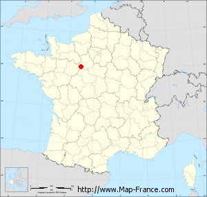
Here is the localization of Le Gault-Perche on the France map of departments in Lambert 93 coordinates. The city of Le Gault-Perche is shown on the map by a red point.
The town of Le Gault-Perche is located in the department of Loir-et-Cher of the french region Centre.
The latitude of Le Gault-Perche is 48.095 degrees North.
The longitude of Le Gault-Perche is 0.979 degrees East.
Here the distance between Le Gault-Perche and the biggest cities of France:
Distances are calculated as the crow flies (orthodromic distance)
Distance between Le Gault-Perche and Paris : 131.79 kilometers
Distance between Le Gault-Perche and Marseille : 633.67 kilometers
Distance between Le Gault-Perche and Lyon : 390.98 kilometers
Distance between Le Gault-Perche and Toulouse : 500.78 kilometers
Distance between Le Gault-Perche and Nice : 687.92 kilometers
Distance between Le Gault-Perche and Nantes : 213.06 kilometers
Distance between Le Gault-Perche and Strasbourg : 503.28 kilometers
Distance between Le Gault-Perche and Montpellier : 546.41 kilometers
Distance between Le Gault-Perche and Bordeaux : 380.38 kilometers
Distance between Le Gault-Perche and Lille : 318.62 kilometers
Distance between Le Gault-Perche and Rennes : 197.3 kilometers
Distance between Le Gault-Perche and Reims : 258.51 kilometers
Clic here to see the map of Le Gault-Perche in full screen:
Le Gault-Perche on the map of french departments
|
This administrative map of Le Gault-Perche is reusable and modifiable by making a link to this page of the Map-France.com website or by using the given code :
|
Administrative base maps of Le Gault-Perche
|

See the administrative base map of Le Gault-Perche in full screen (1000 x 949)
|
Small administrative base map of Le Gault-Perche
|
This base map administrative of Le Gault-Perche is reusable and modifiable by making a link to this page of the Map-France.com website or by using the given code :
|
 French Version : http://www.cartesfrance.fr